
Drone Photogrammetry: How Can You Turn Drone Images into 3D Maps/Models?
November 18, 2021
Blog
UAVs are mostly used in construction sites for drone asset inspection and land surveying. Drones can cover hundreds of acres in hours. Using the drone data insights, surveyors can create 2D maps and 3D models of structures and buildings.
The process of converting site data to 3D models and 2D maps is called drone mapping. Photogrammetry is the process of taking two-dimensional photographs and processing them into three-dimensional, digital models of the real world.
But it’s not always easy to understand how a drone is able to do this — or what hardware and software you need to get started.
This is a step-wise guide to help on-site builders and architects convert images into 3D maps/models.

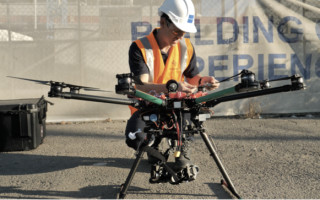
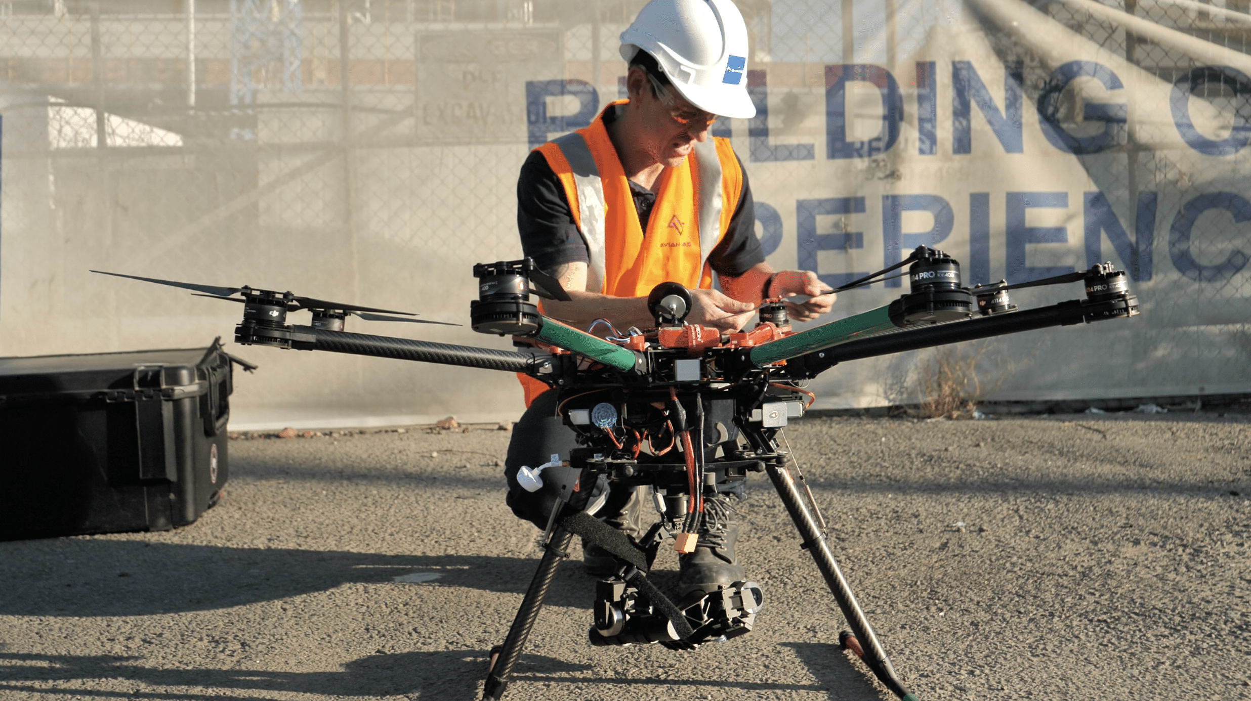
Image source: Avian Australia
1. Get the right drone
Choosing the correct type of drone for your project needs may seem like an obvious point, but it's something I cannot stress enough. The quality of the survey affects how clear and accurate the 3D maps and models turn out.
Most AEC companies have heard about post-processing kinematic (PPK) workflows and real-time kinematic (RTK) drones.
The difference between these two drone types is quite simple. PPK drones apply corrections after the flight. RTK drones, on the other hand, apply corrections to location errors during the drone flight.
The most effective drone surveying combines the two in a fully integrated solution.
Talk to your drone operator about the best way you can incorporate these benefits in your drone surveying plan. The drone surveyor can also guide you about the right photogrammetry software and BIM platform to convert drone footage into videos, 3D maps, and images.
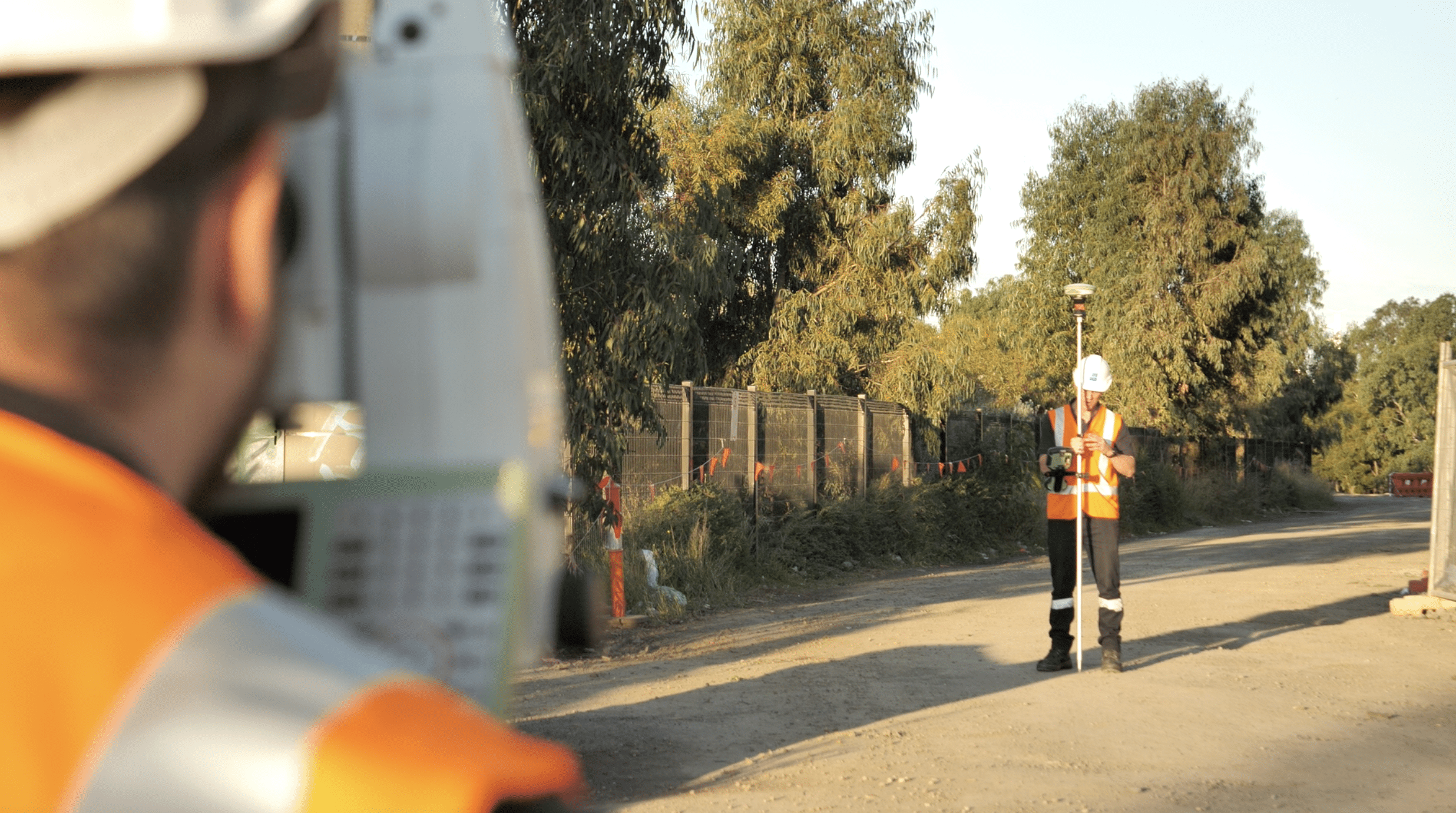
2. Locate and set the GCPs properly
Ground control points (GCPs) are actual points or targets on the ground that work as a frame of reference for the drone pilot. Operating the drone from high up in the air, the drone operator can easily identify the areas that need to be captured on site based on the GCPs. There is no set number of GCPs that you need for a project. It all depends on how big the site is and what level of survey accuracy you want.
A common drone surveying mistake that most AEC companies make is using too few GCPs for their project. It would hamper the drone’s flight and in turn give you blurry or unclear footage of the site.
Remember, the more accurate the survey data is, the better and clearer the 3D model will be.
GCPs keep the aerial footage “grounded” and are used across multiple data sets. These data sets are then compared to locate each image’s true position on the earth. Using GCPs reduces the margin of error from a few meters to a couple centimeters.
If you don’t use GCPs, the 3D models will not have a reliable frame of reference to the actual site location. This might be okay for basic calculations and arbitrary measurements, but for AEC companies, data accuracy is of utmost importance.
The slightest of discrepancies can have dangerous consequences for your project. Using GCPs, surveyors and on-site engineers can also generate time lapse comparisons, i.e. the before and after shots for your construction project.

Image source: Avian Australia
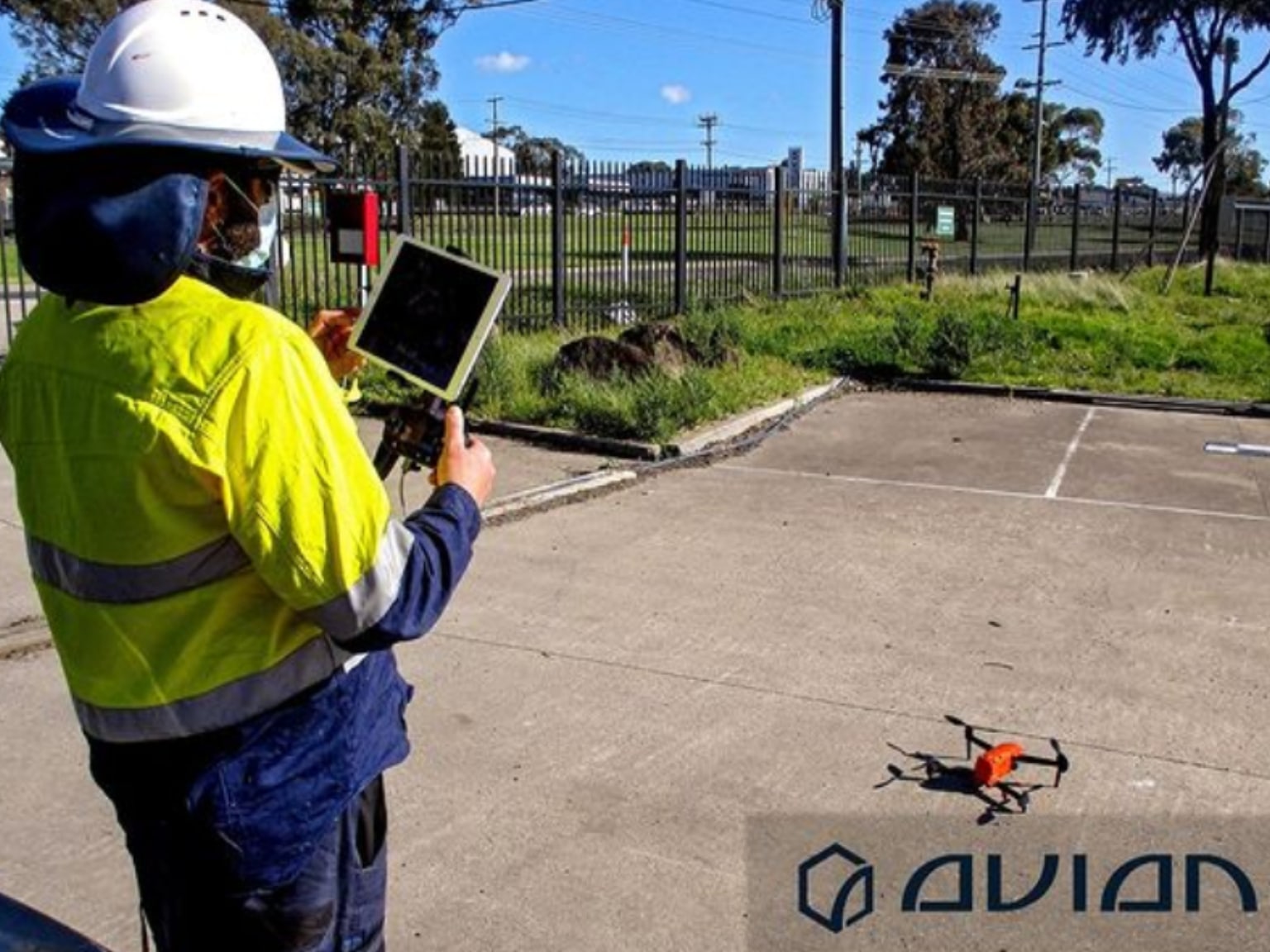
3. Prep your drone and camera equipment
Outsourcing your surveying project to a professional drone operator would ensure that everything goes according to plan. Drone automation has mechanized the entire process of site inspection and aerial photography, but at the end of the day it is controlled by people.
Drone aerial inspections, therefore, are also susceptible to human errors. I make it a point to check and double check everything before a flight. This doesn’t just include the UAV, but also the camera equipment.
Check that your camera is working fine, the battery is properly charged, or that the memory card has ample storage space. There is nothing more annoying than setting up all your equipment for the flight only to find out that nothing was recorded properly.
I would also recommend doing a few test flights first to check if everything is operating fine before you begin the actual drone survey. This would help identify any technical errors and resolve them on the spot.
4. Check the weather report
There are a few things that can hamper a drone’s flight, and bad weather is one of them.
One of the first things the drone operator must do is to check the weather report for the entire week. Plan the flight only on days you see a clear forecast.
According to CASA’s drone regulations, it is unsafe to fly drones on excessively cloudy or rainy days. This is because cloudy skies hamper the operator’s visibility and compromise the integrity of the drone footage captured. Additionally, rain can damage the drone equipment or camera lens.

Image Source: Avian Australia
5. Get the right 3D drone modeling software
There are two stages of drone videography. We have covered the first aspect in the four points above, i.e. flying the drone.
The second (equally important) phase is the post-flight, drone data processing stage, wherein the raw drone footage is exported to a photogrammetry software.
I would recommend first timers to outsource the drone data processing to professionals as well. It is very easy to mess up the hours of hard work spent on the site trying to collect drone footage with just a simple click.
A GIS expert is better equipped to deal with the drone data and ensure that the final result is in accordance with your requirement.
A Business Information Model (BIM) software is usually used to convert drone footage to 3D maps and models. One of the first things you need to consider when choosing a BIM model is: Is it relevant to your industry?
Yes, industry-focused photogrammetry platforms exist and it can be a gamechanger for your project..
For architects, the photogrammetry platform will come with landscaping elements and designs. For engineers, the software will have more precision driven features to monitor site topography, etc.
Construction drone data is usually used for real estate projects and company profile videos. So, the photogrammetry software will have more editing elements to help you beautify the 3D model and make it immersive.
The Bottom Line
Drone videography is a rising industry and many AEC companies want to get on board with it. If you are a contractor architect, engineer, or site manager looking for reliable photogrammetry solutions, reach out to a professional drone surveyor.
Always ask for a drone cost estimate before you begin the project. The drone operator would also request for a physical site visit before offering you a deal.

Chris Patchell is the General Manager & Director of Operations at AVIAN Australia. He is an avid drone enthusiast and loves innovative technologies. Chris is highly motivated and has a very hands-on approach to things and his goal is to create awareness about drone tech in Australian AEC industries.


