Real-Time Kinematic (RTK) Technology: Advancing Precision Applications
June 05, 2025
Blog

Many emerging applications, from autonomous vehicles to smart agriculture, require far greater positional accuracy than conventional GNSS systems can deliver. Real-Time Kinematic (RTK) technology offers centimeter-level precision but has historically been complex, costly, and difficult to integrate into embedded and IoT designs. This article introduces the fundamentals of RTK, explores its challenges, and outlines how modern, integrated platforms such as the Taoglas EDGE™ Locate are simplifying deployment and expanding RTK’s potential across a broad range of high-precision applications.
Real-Time Kinematic (RTK) technology, an advanced satellite navigation technique delivering centimeter-level precision, has become a game-changer in multiple industries. In this article, we describe the operational principles of RTK and illustrate its power by highlighting some of the applications being transformed by its capabilities. As the technology evolves, RTK is becoming increasingly accessible, and we show how highly integrated platforms facilitate increased adoption of RTK by IoT applications.
Overview of RTK
The term Global Navigation Satellite System (GNSS) describes any satellite constellation providing positioning, navigation, and timing (PNT) services on a global or regional basis. The United States’ Global Positioning System (GPS) and Russia’s GLONASS were the forerunners of satellite navigation, and today’s primary GNSS systems include GPS, GLONASS, the European Union’s Galileo, and China’s BeiDou.
GNSS is fundamental to many applications, including navigation, mapping, scientific research, and timing, and the rapidly growing market for positioning technology is driving demand for higher accuracy. GPS accuracy levels of around 3 to 5 meters, although suitable for consumer navigation, are not precise enough for emerging applications such as autonomous driving. Various techniques, including RTK, have been developed to overcome the signaling challenges faced by GNSS and improve its accuracy. RTK works by using a base station, typically fixed, linked to one or several roving users via a communication channel, usually wireless: Figure 1.

Figure 1: RTK works by using a fixed base station linked to one or several roving users via a communication channel (Source: Taoglas)
The base station applies sophisticated statistical methods to the received GNSS carrier signal to eliminate the majority of normal GNSS type errors. Certain details of the received satellite signals are transmitted by the base station to the rover(s), and the rover(s), which are receiving signals from the same satellites, use this data to correct their position in real-time. The base station normally transmits the correction signal at 1-second intervals, which can be increased where data rates are restricted.
RTK correction data can be obtained either from a local fixed base station or received over the internet from a third-party service provider operating an RTK network, usually on a commercial basis. RTK networks consist of a range of RTK base stations forming a coverage area, and these networks collect and transmit corrections data, often using NTRIP (Networked Transport of RTCM via Internet Protocol). Fixed base stations, with a range of around 10 kilometers, are provided globally by companies including Point One Navigation, Geodnet, and RTK FIX. RTK networks, which usually require a per-user subscription and some form of internet access, have the advantage of offering a wide coverage area, which is not limited to a particular region. Various free and paid RTK networks exist globally, and users can find service providers in their region by consulting portals such as NTRIP-list.com.
Despite its many advantages, RTK faces several operational and environmental challenges, including:
Speed: The time taken to acquire the satellite signal and perform the necessary calculations to reach a fixed position depends heavily on the number of signals available to the receiver. A multi-frequency, multi-constellation GNSS receiver will calculate the position significantly faster than a GPS-only system, but multi-constellation receivers are correspondingly more complex and costly.
- Sensitivity to signal quality: RTK is sensitive to signal quality and availability, which can limit performance in environments with signal obstructions, such as urban canyons and dense foliage. This is being addressed by the introduction of new satellite signals with improved signal strength and quality, and, again, can be overcome by enhanced receiver design.
- Range Limitation: RTK’s accuracy decreases with the distance between base and rover stations, limiting range to between 10 and 20 kilometers. This can be addressed using a commercial RTK network, which will usually require a subscription with a service provider.
A range of innovative technologies has been developed in response to these challenges, including new and improved quality satellite signaling and advancements in receiver technology. Modern GNSS receivers are designed to take full advantage of the new satellite signals, incorporating advanced processing techniques and algorithms. Multi-constellation systems, which receive signals from multiple satellites simultaneously, significantly reduce the likelihood of positioning errors due to signal obstructions or multipath effects. Latest generation receivers can receive signals simultaneously from over 30 satellites, offering improved performance, faster initialization times, and greater resilience to signal degradation, providing more reliable and accurate RTK positioning.
RTK GNSS has emerged as a game-changing technology, enabling a wide spectrum of applications across various industries that depend upon high-accuracy positioning data.
High Precision Applications Enabled by RTK
The global market for positioning systems was valued at US$ 94.25 billion in 2022 and is forecast to grow at a CAGR of 16.1% between 2023 and 2030. Location-based services accounted for almost 43% of this market in 2022, with GNSS technology enabling a wide spectrum of applications, including road, aviation, and marine, location-based services, surveying and mapping, smart construction, precision agriculture, and, unsurprisingly, autonomous driving. Applications that leverage the accuracy and precision of RTK include:
Surveying and Mapping
RTK GNSS transforms the field of surveying and mapping by enabling precise mapping of land, infrastructure, and natural resources, significantly facilitating urban planning, construction projects, and environmental studies.
Agriculture
RTK GNSS plays a vital role in precision agriculture, providing accurate positioning information that enables optimized field management with pinpoint accuracy. Farmers can implement site-specific crop management programs, reducing resource wastage and improving crop yields. Precision planting enabled by RTK technology can significantly reduce fertilizer usage, while optimized field management significantly boosts crop yields.
Construction and Engineering
RTK GNSS enhances project efficiency and precision in the construction and engineering sectors, enabling precision machine control for excavation, grading, and paving operations, reducing rework and boosting productivity. RTK-integrated machinery also enables guided operation of heavy equipment like excavators and graders, minimizing errors, reducing material wastage, and optimizing time.
Autonomous Vehicles
RTK GNSS is crucial to autonomous driving, where safe navigation demands precise positioning in real-time and in a range of challenging environments. RTK GPS is integral to vehicle control systems, maintaining precise routes, detecting lane positions, and avoiding obstacles in real time. Whether it's self-driving cars, drones, or maritime vessels, RTK GNSS ensures vehicles always know their precise location, whether on the road, at sea, or in the air.
RTK Futures
As RTK continues to evolve, several trends and developments are shaping the capabilities of the technology:
- The ongoing introduction of new GNSS constellations, along with the modernization of existing systems like GPS and GLONASS, continues to improve the availability, reliability, and accuracy of GNSS signals.
- The coverage of RTK GNSS reference stations continues to expand as collaborations between government agencies, private companies, and research institutions establish comprehensive RTK networks. At the same time, integration of RTK with 5G networks promises faster data transmission and enhanced real-time positioning accuracy for mobile applications.
- RTK GNSS is increasingly integrated with advanced technologies such as LiDAR, computer vision, and artificial intelligence (AI), enhancing its overall accuracy and robustness and unlocking new possibilities in various applications.
- Miniaturization and cost reduction trends in electronics are making RTK GNSS technology more accessible and driving its integration with the IoT. Smaller, more power-efficient receivers, combined with reduced hardware costs, are facilitating the adoption of RTK GNSS in a wide range of IoT applications, including precise asset tracking, automated urban infrastructure monitoring, and smart city navigation systems. The RF antenna is a critical front-end component of any receiver, and antenna selection and design can be a complex and time-consuming process. The designer’s task can be simplified by leveraging the capabilities of specialist organizations such as Taoglas, which offer a range of products and support services, including off-the-shelf antennae and online design tools. Additionally, highly integrated modules such as Taoglas’ EDGE Locate platform simplify access to RTK GNSS, technology that reduces development cycles and accelerates time to market.
RTK Integration for IoT Developers
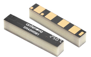
Building on this approach, the example shown in Figure 2 provides high-precision GNSS location functionality in an off-the-shelf, compact form factor. Combining a GNSS L1/L2/E5b/B2b antenna, RF electronics, and receiver technology in a single package, the device is designed to support reliable, high-accuracy positioning for both large-scale and niche navigation and autonomous applications.

Figure 2: The energy-efficient Taoglas EDGE Locate IoT platform provides high-precision GNSS location functionality (Source: Taoglas)
It enables developers to quickly and effectively build IoT devices with centimeter-level positioning technology, without having to invest in costly and lengthy RF design, integration, and testing processes. Enterprises can future-proof their IoT deployments and optimize location-based performance with multi-band GNSS technology and optional RTK capabilities.
Once the preserve of large organizations and higher-value industrial sectors, RTK GNSS technology is becoming more accessible, transforming a growing range of applications with its centimeter-level precision. Advanced satellite infrastructure, receiver design, and the miniaturization of electronics are rapidly bringing the benefits of this game-changing technology to the IoT. Taoglas’ EDGE Locate has been developed for mass-market RTK GNSS positioning and is complemented by a portfolio of high-precision antennas.
For more information, visit: https://www.taoglas.com/
Patrick Frank is an RF and Antenna Engineer at Taoglas with over 15 years of experience in the wireless industry. He holds a Bachelor of Science in Electrical Engineering (BSEE) from Minnesota State University.

Patrick Frank is an RF and Antenna Engineer at Taoglas with over 15 years of experience in the wireless industry. He holds a Bachelor of Science in Electrical Engineering (BSEE) from Minnesota State University.